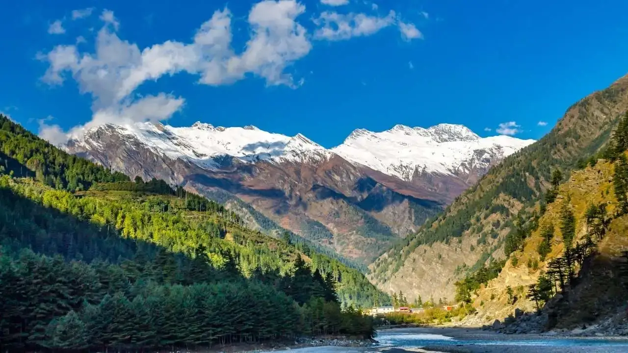
Harsil Valley Tour Package from Rishikesh – The Mini Switzerland of Uttarakhand scenery landscape background

Harsil Valley Tour Package from Rishikesh – The Mini Switzerland of Uttarakhand

Trek through pristine alpine meadows and dense oak forests to the sacred fourth temple of Lord Shiva, set against the towering peaks of Chaukhamba.

🏔️ Himalayan Valley Explorations

Tour Overview

There is a valley in Uttarkashi that most people drive past on their way to Gangotri without stopping. That is a mistake.

Harsil Valley — often called the "Mini Switzerland of India" — is one of the most breathtaking yet lesser-known destinations in the Indian Himalayas. It sits at 2,620 metres above sea level on the banks of the Bhagirathi River, surrounded by snow-capped peaks, dense deodar forests, terraced apple orchards, and charming villages. Unlike Mussoorie or Nainital, Harsil has no traffic jams, no souvenir shops, no noise. Just the Bhagirathi rushing past, apple trees leaning over stone walls, painted Tibetan-influenced houses, and the Bandarpunch range sitting on the horizon.

The valley is a cluster of eight small villages — Sukkhi, Jhala, Jaspur, Purali, Harsil, Bagori, Mukhba, and Dharali — each offering a unique blend of Garhwali and Bhotiya cultures amidst the scenic backdrop of the Garhwal Himalayas.

This is not a trek package in the conventional sense. This is a valley exploration — drives through mountain roads, short hikes to viewpoints and seven-lake trails, village walks through Bhotiya settlements, a Gangotri Dham visit, and the kind of unhurried Himalayan days that most people forget exist. We depart from Rishikesh, drive through Tehri and Uttarkashi, and arrive in one of Garhwal's most genuine mountain valleys.

4 days. ₹12,000 per person. Everything included.
📅 Route Progression Schedule

Harsil Valley Tour — 4-Day Itinerary from Rishikesh

📍 Day 1 — Rishikesh to Harsil Valley (Drive)

Drive Distance ~260 km
Drive Time 9–10 hours
Altitude Shift 372m → 2,620m
Difficulty Easy — full day drive
Overnight Stay Guesthouse/homestay at Harsil or Bagori village

Depart Rishikesh early — 5:00 AM is ideal. The drive itself is one of the most scenic in Garhwal. The road climbs steadily through Tehri, past the massive Tehri Dam reservoir that shimmers in the early morning light, then continues north through Uttarkashi — the district headquarters and a significant religious town with the ancient Vishwanath Temple of Lord Shiva at its heart (worth a 20-minute stop for darshan).

From Uttarkashi, the road follows the Bhagirathi River upstream as it narrows into the mountains. Stop at Maneri Dam (~63 km from Harsil) and the Khedi Waterfall just above it — two of the most photographed spots on this route. Continue through the villages of Bhatwari, Gangnani (famous for its natural hot water springs — step in if you have time), and Sukki Top where apple orchards line both sides of the road with views of the valley below.

As you approach Harsil, the dense deodar forest closes in on both sides, the Bhagirathi turns a deeper turquoise, and the painted wooden houses of the valley begin to appear. Cross the bridge over the Jalandhari River into the main Harsil market. Check in, freshen up, and spend the evening walking along the river. Your first real experience of Harsil is best taken slowly.

Highlights en route:
  • Tehri Dam reservoir — one of Asia's highest dams
  • Vishwanath Temple, Uttarkashi
  • Maneri Dam and Khedi Waterfall
  • Gangnani hot springs
  • Sukki Top — apple orchards and valley views
  • First views of Harsil and the Bhagirathi
Drive from Rishikesh to Harsil Valley through Tehri Uttarkashi following Bhagirathi river Garhwal Himalayas

Day 1 Segment

Overland Mountain Transit

📍 Day 2 — Bagori Village, Lama Top Hike & Mukhba Village

Hike Distance ~2.5 km one way
Hike Time 2–3 hours return
Lama Top Altitude ~3,000m
Difficulty Moderate — steep in sections
Overnight Stay Harsil/Bagori

Start the morning with a walk to Bagori Village — just 1 km from Harsil across a wooden bridge over the Jalandhari River. Bagori is the most culturally distinct village in the valley, home to the Jadh Bhotiya community — an indigenous people originally from the Nelong Valley near the Tibetan border, relocated here after the 1962 Sino-Indian War. Their intricately carved wooden houses with colourful rooftops, Buddhist monasteries sitting alongside Hindu temples, and handwoven woollen shawls (Dumka and Pankhi) make Bagori unlike any village in the Garhwal mainstream.

From Bagori, begin the Lama Top hike — approximately 2.5 km each way, with a steady climb through rhododendron and pine forest that steepens in the upper section. The trail is short but rewarding: at the top (3,000m) you get a bird's-eye view of the entire Harsil Valley — the Bhagirathi threading through it like a silver ribbon, Bagori's wooden houses below, and the Bandarpunch range, Mt. Srikanth, and the Horns of Harsil standing in a wall across the horizon. It is one of the finest valley viewpoints in Uttarkashi district. Lama Top is also sacred to Buddhist visitors — the name itself reflects the Buddhist cultural presence in the region.

Descend by early afternoon and drive to Mukhba Village (~6.5 km from Bagori). Mukhba is spiritually significant year-round but in different ways depending on the season:

  • Summer: The village sits quietly above the river with its terraced houses and the Mukhimath temple visible from below. Views of sunrays striking Mt. Srikanth from Mukhba are exceptional.
  • Winter (November–April): Mukhba becomes the winter abode of Maa Ganga — when Gangotri Temple closes due to snow, the deity's idol is ceremonially brought here and worshipped through the winter months. Pilgrims come here for darshan even when Gangotri is inaccessible.

Explore Mukhba, attend the evening temple prayers, and return to Harsil for dinner.

Highlights:
  • Bagori Village — Jadh Bhotiya culture, Buddhist monastery, carved wooden houses
  • Lama Top (3,000m) — finest valley panorama in Harsil
  • Views of Bandarpunch range, Mt. Srikanth, Horns of Harsil
  • Mukhba Village — winter Gangotri, Mukhimath Temple
  • Bhimganga waterfall (200–300m from Mukhimath)
View of Harsil Valley from Lama Top viewpoint 3000m with Bandarpunch range and Bhagirathi river below Uttarkashi

Day 2 Segment

Valley Panoramas & Heritage

📍 Day 3 — Gangotri Dham + Gartang Gali (Summer) / Sattal Trek & Dharali Village (Year-round)

This day has two versions depending on whether you visit in summer (Gangotri open) or visit for Sattal trek. We plan your Day 3 based on your travel dates and the temple opening calendar.

☀️ Summer Option (May–October):
Drive Route Harsil → Lanka → Gangotri
Drive Distance ~26 km total
Gangotri Altitude 3,100m / 10,170 ft
Gartang Gali Hike ~2.5 km (1.5–2h)

Start early (7:00 AM). Drive toward Gangotri — the road follows the Bhagirathi through increasingly dramatic gorge scenery. Stop at Lanka Bridge, the highest motorable bridge in Uttarakhand, where the view into the Nelong Valley below — the Jadh Ganga twisting through a cold-desert landscape of vertical grey mountains — is genuinely staggering.

From Lanka Bridge, take the Gartang Gali trail. This 150-year-old wooden cliff-side walkway was originally part of the historic Indo-Tibetan salt trade route, used for centuries by merchants carrying salt, wool, spices, and grain across the high Himalayan passes between India and Tibet. The walkway is built by cutting into the vertical granite face of the mountain — 136 metres of narrow wooden steps and a handrail suspended over a gorge above the Jadh Ganga. Closed after the 1962 Sino-Indian War, it was reopened for tourists in 2015. Walking it feels like walking through Himalayan history. Gartang Gali entry requires a permit (~₹200 per person, not included in package price).

Continue to Gangotri Temple — one of the four sacred Char Dham sites and the highest Char Dham temple, dedicated to Maa Ganga. Situated at 3,100m on the banks of the Bhagirathi, surrounded by deodar trees and snow-streaked peaks, the white temple is both spiritually powerful and visually breathtaking. Attend the evening aarti if timing allows. Visit Bhagirath Shila — the rock on which King Bhagirath meditated for thousands of years to bring the Ganga from the heavens to earth.

Return to Harsil by evening.

🌊 Sattal Trek Option (Day 3 alternative — available all seasons, summer recommended):
Trek Route Dharali Village → Sattal
Trek Distance ~4 km one way
Trek Time 3–4 hours return
Trek Altitude Above 2,600m

Drive to Dharali Village (~7 km from Harsil) — a quiet hamlet with apple orchards, traditional stone-roofed houses, and the ancient Kalp Kedar Temple, a 5,000-year-old Shiva temple believed to have been originally built by the Pandavas. The Shivling inside is partially submerged under the Khera Gad stream — one of the most unusual temple settings in Garhwal.

From Dharali, begin the hike to Sattal — which literally means "seven lakes." The trail climbs steeply through dense pine and oak forest, opening onto a plateau of seven interconnected high-altitude freshwater lakes:

The Seven Lakes of Harsil Sattal:
🔹 Mirdunga Tal
🔹 Chadgiya Tal
🔹 Dawariya Tal
🔹 Bamniya Tal
🔹 Rikh Tal
🔹 Ghandoliya Tal
🔹 Sankhghata Tal

Each lake is distinct in size, colour, and surrounding vegetation. The area is almost entirely visited by forest birds, and the silence is broken only by birdsong and the rustle of pines. At the high point of the Sattal trail, views of the snow-covered Kalanag (Black Peak) of the Bandarpunch range and Swargarohini Peak open up on the horizon.

Important: Sattal is only accessible in summer — the lakes freeze and the trail becomes unsafe in winter. We plan the Sattal trek only for summer departures.

Return to Harsil for dinner.

Highlights:
  • Lanka Bridge — highest motorable bridge in Uttarakhand and Nelong valley gorge views
  • Gartang Gali Walkway — 150-year-old historic wooden cliff walkway suspended over Jadh Ganga gorge
  • Gangotri Temple — high altitude Chham Dham pilgrimage site dedicated to Maa Ganga
  • Dharali Village & 5000-year-old Kalp Kedar Temple submerged in mountain stream
  • Sattal Lakes — network of 7 high-altitude forest lakes under Bandarpunch range
Harsil Sattal seven lakes trail above Dharali village Uttarkashi Uttarakhand alpine lakes Himalaya

Day 3 Segment

High Alpine Routes & Dhams

📍 Day 4 — Laxman Temple Trek + Awana Bugyal View + Drive to Rishikesh

Morning Trek Mukhba → Laxman Temple
Awana Bugyal Visible from Purali
Drive Distance ~260 km, 9–10 hours
Drive Route Harsil → Uttarkashi → Tehri
Overnight Stay Return to Rishikesh

Rise early for the final morning in the valley. Drive back to Mukhba for the short trek to the Laxman Temple — a small but spiritually important temple that sits above the village on a forested ridge. The trek from Mukhba is a peaceful forest walk, quieter than the main village trail, with views back toward the valley and the Bhagirathi below. Locals consider this one of the more sacred spots in the Mukhba area, visited less frequently than the Mukhimath temple but carrying a quiet, undisturbed atmosphere that is its own reward.

On the drive back toward Harsil and then Purali, look up toward the ridge above — the green meadow visible from the road is Awana Bugyal, an alpine meadow located approximately 17 km from Harsil that sits above the village of Purali. Awana Bugyal is a camping destination that few visitors know about — the name came from elders of Purali village who remember it from generations of pastoral use. From Awana Bugyal, views of the surrounding peaks are extraordinary. (Note: If your group wants a dedicated Awana Bugyal hike, we can customise your itinerary to add a half-day there — ask us when booking.)

Board the vehicle and begin the return drive to Rishikesh via Uttarkashi. Stop for lunch in Uttarkashi. Arrive Rishikesh by evening. End of package.

Highlights:
  • Laxman Temple Trek — peaceful ridge forest trail above Mukhba
  • Awana Bugyal landscape observation from Purali Village road
  • Bhagirathi River valley return traverse
  • Midday transit stopover in Uttarkashi
Return drive from Harsil Valley through Uttarkashi following Bhagirathi river toward Rishikesh Garhwal Himalayas

Day 4 Segment

High Ridge Sunrise Sweep

💰 Transparent Tariff

Tour Package Price — ₹12,000 per person

What's Included

Return transport from Rishikesh (shared vehicle — SUV or Tempo Traveller based on group size)
3 nights accommodation at Harsil or Bagori (guesthouse / homestay)
All meals: 3 breakfasts + 3 dinners (lunches on trekking days)
Experienced local guide for hikes (Lama Top, Sattal, Laxman Temple)
Toll charges and parking fees on route
First aid kit
RideRishikesh coordinator available on WhatsApp throughout

What's Not Included

5% GST on package price
Gartang Gali entry permit (~₹200 per person, paid locally)
Gangotri Temple registration (if applicable — paid locally)
Personal trekking gear — shoes, rain jacket, warm layers
Meals during road journey (Day 1 and Day 4 drives)
Personal shopping or donations at temples
Nelong Valley Inner Line Permit (if you wish to visit — requires separate advance application)
Emergency evacuation costs
Anything not listed under inclusions
📜 Mountain Lore & Heritage

History and Culture of Harsil Valley

The Name — Harsil

The name Harsil is believed to have originated from a local legend. When the Bhagirathi and Jalandhari rivers argued over which was more significant, Lord Vishnu intervened — turning himself into a shila (rock) to absorb the turbulence of both rivers and allow them to merge. Harsil is thus derived from "Hari" (Lord Vishnu) and "Shil" (rock).

Frederick "Pahari" Wilson — The Raja of Harsil

The most fascinating chapter in Harsil's recorded history belongs to an Englishman. In 1842, Frederick Wilson, a 25-year-old Englishman, deserted the East India Company's army and fled to remote Harsil, where he made a fortune by logging deodar trees and selling them to the British for the construction of railways. He was nicknamed the "Raja of Harsil" by locals and even issued his own coins.

Wilson introduced apple cultivation and other cash crops like rajma to the valley — the apple orchards that define Harsil's landscape today are his legacy. He was a friend of A.O. Hume and Rudyard Kipling; the latter's novel The Man Who Would Be King is said to have been inspired by Wilson's story. His original mansion at Harsil stood until a fire destroyed it in 1997; the Forest Rest House at its site still carries a sign reading "Wilson House — Harsil."

The Jadh Bhotiya Community

Harsil had old ties with Tibet when trade and marriages thrived between the two places. After the Indo-China war in 1962, the situation changed. For safety purposes, the native communities of Nelong Valley — known as Jadh Bhotiyas — were relocated to Bagori village in Harsil Valley.

The Jadh Bhotiyas speak a Bhoti language closely related to Tibetan and maintain a culture that blends Tibetan Buddhist traditions with Garhwali Hindu customs. Their carved wooden houses in Bagori, Buddhist monasteries alongside Shiva temples, and handwoven woollen shawls represent a living cultural synthesis found nowhere else in the Garhwal Himalaya.

Gangotri — The Source of the Ganga

Gangotri Temple sits 26 km from Harsil at 3,100m on the banks of the Bhagirathi — one of the four Char Dham pilgrimage sites and the sacred origin point of the Ganga. The temple opens each year in May (around Akshaya Tritiya) and closes in November (Diwali). When it closes, the deity is ceremonially brought to Mukhba village near Harsil for winter worship — a tradition the Semwal priest community has maintained for generations.

🌱
Temple Opens May (usually around Akshaya Tritiya — exact date changes annually)
🍂
Temple Closes November (around Diwali)
❄️
Winter Deity Seat Mukhba Village Near Harsil
📅

Note: Always verify the exact opening date for the current year before booking. We'll keep you updated when you WhatsApp us.

Get Date Updates

Harsil and Bollywood

Harsil shot to fame as the shooting location for Raj Kapoor's blockbuster movie Ram Teri Ganga Maili. The painted murals on village walls in Harsil still feature the actor's image alongside Yaks, Bharal (blue sheep), and the valley's famous apples — a reminder of how deeply the film embedded itself in local memory.

🌲 Sanctuary Ecosystems

Flora & Fauna of Harsil Valley

The valley is recognised as an Important Bird Area (IBA) and is the only breeding site of the Ibisbill in the region — a bird much sought-after by birdwatchers. The Ibisbill's habitat is unique as it needs slow-flowing rivers at high altitude for sustenance. With 203 bird species recorded in the Gangotri landscape, Harsil Valley is one of the finest birdwatching destinations in the western Himalaya.

The vegetation features rich high-altitude forest cover and iconic local agricultural crops:

🌲 Trees:

Deodar Cedar, Himalayan Oak, Birch (Bhojpatra), Rhododendron (Buransh), Pine, Spruce, Juniper, Maple, Chestnut

🌸 Notable Flora:
  • Apple orchards — Harsil produces Golden Delicious, Royal Delicious, and Red Delicious varieties, introduced by Frederick Wilson
  • Famous Harsil Rajma — a local bean variety of exceptional flavour, cultivated by the Jadh Bhotiya community
  • Wild rhododendron in bloom (March–April)
  • Alpine wildflowers in the Sattal meadows and Lama Top approach
  • Medicinal and aromatic plants throughout the forest zone
Ibisbill bird on Bhagirathi river banks Harsil Valley Uttarkashi Uttarakhand birdwatching

Avian Species

Ibisbill Habitat Focus

🐾 Mammals Network Directory
Carnivores: Snow Leopard, Common Leopard, Himalayan Black Bear, Brown Bear, Red Fox, Yellow-throated Marten
High Altitude Ungulates: Himalayan Tahr, Himalayan Musk Deer, Himalayan Blue Sheep (Bharal), Serow
Primates & Small Mammals: Common Langur, Himalayan Palm Civet
🦅 Avian & Bird Records (203+ species in the Gangotri landscape)

Ibisbill — rare, breeds here; the valley is its only known breeding site in the region. Himalayan Monal (Danphe) — spotted in deep forest areas. Koklass Pheasant, Kalij Pheasant, Himalayan Griffon, Lammergeier (Bearded Vulture), Golden Eagle, Harial (yellowish-green, in oak forest sections), Fakta (large dove), Malyo (slaty grey bird), Magpie, Thrush, Paradise Flycatcher, Golden Oriole, Sunbird, Robin, Parakeet, Snow Sparrow, Alpine Chough, and Russet Sparrow (especially around Bagori).

📸

Birdwatcher's tip: The riverbed cobblestone zones of the Bhagirathi are where you can find the elusive Ibisbill. Early mornings around Bagori village offer the best opportunities for checking out snow sparrows and raptors.

☀️ Climate & Planning Calendar

Best Time for the Harsil Valley Tour

January–February

Snow-covered valley. Extremely cold (-8°C nights). Most locals have migrated.

❌ Not recommended
March

Snow melting. Rhododendrons starting. Gangotri still closed.

⚠️ Limited
April–May

Apple blossoms, rhododendrons. Gangotri opens (~mid-May). Pleasant days (10–20°C).

✅ Excellent
June

Peak summer. Lush green. All sites accessible. Best for Sattal trek.

✅ Best
July–August

Monsoon. Heavy rain, landslide risk on approach road.

❌ Avoid
September

Post-monsoon clarity. Brilliant skies. Apple harvest begins.

✅ Best
October

Apple harvest at peak. Golden valley. Clear Himalayan views.

✅ Excellent
November

Gangotri closes (Diwali). Mukhba becomes the winter Gangotri. Snow likely above 3,000m.

⚠️ Limited
December

Snow arrives. Valley becomes quiet and cold. Some closures possible.

⚠️ Limited
💡

Our recommendation: April–June for blossom and greenery; September–October for apple harvest, clear skies, and the finest mountain views.

Note on winter visits: Harsil in winter (December–February) has a distinct, quiet beauty — snow-covered orchards, frozen streams, the valley almost empty. It is accessible but requires preparation for cold and possible road closures. Contact us for current road conditions if planning a winter departure.
🗺️ Transport & Terminal Vectors

How to Reach Harsil Valley (From Rishikesh)

(If you book with RideRishikesh, all transport is arranged as part of the package.)
✈️
By Air

Nearest airport — Jolly Grant Airport, Dehradun (~35 km from Rishikesh). Flights from Delhi, Mumbai, Bangalore.

🚂
By Train

Rishikesh Railway Station. Direct trains from Delhi.

🚗
By Road

Rishikesh → Tehri → Uttarkashi → Harsil
Distance & Time: ~260 km | 9–10 hours via NH-34

📍 Key stops en route:
  • Tehri (~100 km from Rishikesh) — Tehri Dam reservoir
  • Uttarkashi (~170 km from Rishikesh) — last major town, fuel here
  • Maneri Dam and Khedi Waterfall — 63 km before Harsil
  • Gangnani hot springs — 35 km before Harsil
  • Sukki Top — 20 km before Harsil
⚠️ Important notes:
  • Fill fuel at Uttarkashi — there are no petrol pumps beyond this point until Harsil
  • 💵 Carry sufficient cash from Uttarkashi — no ATMs in Harsil
  • 🪪 Harsil is near the Indo-Tibet border — carry government-issued photo ID (checked at checkposts)
🎒 Equipment & Logistics Compliance

What to Pack for the Madhyamaheshwar Trek

🧥 Clothing & Footwear
  • Full-sleeve thermal base layer (essential even in summer — nights are cold above 3,000m)
  • Fleece jacket or woollen sweater
  • Windproof/waterproof outer jacket
  • Quick-dry trekking pants (2 pairs)
  • Warm cap and gloves
  • Waterproof poncho or rain jacket
  • Sun cap for daytime
  • Sturdy trekking/hiking shoes with ankle support (non-negotiable)
  • Camp sandals/slippers for evenings
  • Woollen or thick trekking socks (3–4 pairs)
⚙️ Backpack & Gear
  • Day backpack 30–40 litres with rain cover
  • Trekking poles (highly recommended for the steep Day 3 ascent and descent)
  • Headlamp with spare batteries
  • Refillable water bottle (1 litre minimum — single-use plastic is banned in the sanctuary)
  • Water purification tablets
🩺 Health & Safety
  • Personal medicines (altitude sickness, pain relief, anti-diarrheal, band-aids)
  • ORS sachets
  • Sunscreen (SPF 50+) and lip balm
  • Hand sanitiser
  • Original government photo ID (Aadhaar / Passport / Voter ID)
  • Photocopy of ID
  • Trek permit (arranged by RideRishikesh)
🛑 Important — What NOT to Bring
Banned Plastics Single-use plastic bottles or bags (banned in Kedarnath Wildlife Sanctuary)
Alcohol Restrictions Alcohol (high altitude + alcohol increases AMS risk significantly)
Media Equipment Heavy camera equipment (every extra kg matters on Day 3)
Weight Target More than 12–15 kg total pack weight
🗺️ Regional Landmarks & Extensions

Nearby Attractions

⛰️ Budha Madhyamaheshwar 3,583m

Budha Madhyamaheshwar (3,583m) — 2–3 km above the main temple. The finest viewpoint of the entire trek. Included in our Day 4 itinerary.

🌊 Deoria Tal ~45 km away

Deoria Tal — a sacred lake in the Garhwal Himalayas, ~45 km from Madhyamaheshwar. The reflection of Chaukhamba in its still waters is iconic.

🏕️ Chopta ~30 km away

Chopta — the "Mini Switzerland of Uttarakhand," ~30 km away. Base for the Tungnath–Chandrashila trek.

🛕 Tungnath Temple 3,680m

Tungnath Temple (3,680m) — the third Panch Kedar and the highest Shiva temple in the world. Accessible from Chopta.

🔱 Kalimath Temple ~30 km Peetha

Kalimath Temple — one of the 108 Shakti Peethas, ~30 km away.

❄️ Omkareshwar Temple, Ukhimath Winter Seat

Omkareshwar Temple, Ukhimath — winter abode of the Kedarnath deity. An important stop on the drive to Ransi.

🧗 Kanchani Tal 6 km Route

Kanchani Tal — a difficult-grade 6 km extension trek from Madmaheshwar for experienced trekkers.

🏹 Kedarnath Trek ~70 km away

Kedarnath Trek — the first and most famous Panch Kedar, accessible from Gaurikund (~70 km from Ransi).

📋 Overview & Facts

Quick Facts Matrix

Harsil Valley Circuit Parameters

All-Inclusive Package Price ₹12,000 / per person
🏔️
🌿 Package Type Valley Exploration + Nature Hike
🟢 Grade Easy to Moderate
🏔️ Harsil Altitude 2,620m / 8,596 ft
📈 Lama Top Altitude ~3,000m / 9,843 ft
🛕 Gangotri Temple Altitude 3,100m / 10,170 ft (summer)
🏡 Mukhba Village Altitude ~2,610m / 8,563 ft (winter Gangotri)
🌊 Sattal (Seven Lakes) Above 2,600m, accessible in summer only
Duration 4 Days / 3 Nights
📍 Starting Point Rishikesh
🚗 Route Rishikesh → Tehri → Uttarkashi → Harsil
🍂 Best Time April–June, September–November
💰 Package Price ₹12,000 per person
👨‍👩‍👧‍👦 Suitable For Families, couples, solo travellers, senior citizens, pilgrims
📲 Book Now
💬 Transparency Hub

Frequently Asked Questions — Madhyamaheshwar Trek

Ask on WhatsApp
A1: Madhyamaheshwar Temple is situated at 3,497 metres (11,473 feet) above sea level. The optional Budha Madhyamaheshwar viewpoint above the temple reaches 3,583 metres.
A2: The trek is rated moderate. It is suitable for beginners with a reasonable level of physical fitness — particularly the ability to walk 10–13 km per day on forest trails. The Day 3 ascent from Gaundhar to the temple is the hardest section, with around 1,247m of altitude gain in 11 km. Preparation — daily walking and stair climbing for 3–4 weeks before — is strongly recommended.
A3: The one-way distance from Ransi village to Madhyamaheshwar Temple is approximately 24 km. The complete round trip is approximately 48 km, trekked over Days 2–5 of our 5-day package. Adding the Budha Madhyamaheshwar extension makes the total approximately 51 km.
A4: The temple generally opens in mid-May (around Akshaya Tritiya) and closes in early November (around Diwali). Exact dates follow the Hindu lunar calendar and change slightly each year. During the closed season, the deity is worshipped at Omkareshwar Temple in Ukhimath. Contact us on WhatsApp for the current year's exact dates.
A5: The package includes return transport from Rishikesh, 4 nights accommodation, all trek meals (breakfast + lunch + dinner on trek days), an experienced local guide, Kedarnath Wildlife Sanctuary forest entry permit, group equipment porterage, and first aid. See the full inclusion list above.
A6: The trek reaches 3,497–3,583m, which is high enough for mild Altitude Mountain Sickness (AMS) to affect unacclimatized individuals. Symptoms include headache, nausea, and fatigue. Walking slowly, staying well-hydrated, avoiding alcohol, and not rushing the ascent significantly reduces the risk. Our 5-day itinerary is paced to allow gradual acclimatization. If you have any pre-existing heart or respiratory conditions, consult your doctor before booking.
A7: Yes. Ponies and porters are available for hire at Ransi village. These can carry luggage or carry passengers who have difficulty walking. This is not included in the package price but can be arranged locally.
A8: The temple remains open during monsoon, but the trail becomes significantly more challenging — slippery paths, leeches in the forest section, heavy rain, and occasional landslides on the approach road. We strongly advise against monsoon trekking on this route for first-time trekkers.
A9: Budha Madhyamaheshwar is a smaller upper shrine located approximately 2–3 km above the main temple at 3,583m. It offers a 360° unobstructed view of the surrounding Himalayan peaks including all four Chaukhamba summits, Shivling, and Kedarnath. It is the finest panoramic viewpoint on the entire trek. We include this as a sunrise excursion on Day 4 — it is absolutely worth the early start.
A10: Send us a WhatsApp message on +91 76682 30086 with your preferred travel dates and group size. We'll confirm available departure dates, answer any questions, and share booking and payment details. A partial advance is required to confirm your spot.
⭐ Trekker Feedback

What Our Trekkers Say

✍️

Verified Review Feed

(Testimonials and reviews to be added here — Google Reviews / WhatsApp review cards)

⚡ Direct Reservation Channel

Ready for the Madhyamaheshwar Trek?

The Madhyamaheshwar trek is one of the most spiritually and visually rewarding treks in the Garhwal Himalaya — and one of the least crowded. We run guided departures from Rishikesh with small groups, experienced local guides, and everything taken care of.

Package Price: ₹11,000 per person (inclusive of transport, accommodation, meals, guide, permits)
Rishikesh
ऋषिकेश
🛵 Your Adventure Is Moving

Explore at Your Own Pace

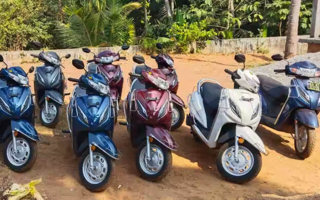
Premium scooty rent rishikesh self drive vehicle accelerating beautifully across tracking viewport dimensions